
GIS-based MGNREGA Training to the capacities of block-level functionaries held
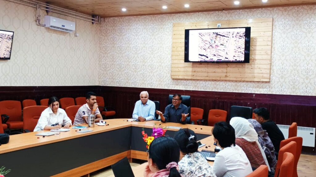
Leh, August 23: To enhance the capacities of the block level functionaries for developing MGNREGA plans by using GIS tools the training on “GIS-Based MGNREGA Planning” was organised by GIZ India and Government of UT Ladakh at Leh district from 17th to 19th August and 21st to 23rd August 2023.
The training intends to promote livelihood works, addressing water security and climate change as programmed under the WASCA-II initiative of GIZ India.
The Water Security and Climate Adaptation in Rural India-II (WASCA-II) approach adheres itself to the integration of land, water, and vegetation for the livelihood enhancement of farmers by strengthening NRM-based activities in 15 Agro Climatic Zones of India and follows the Composite Water Resource Management Plan (CWRM) framework to achieve convergence of government schemes and appropriate implementation and timely monitoring.
To provide the technical expertise under the project GIZ had a contract with Joint Venture partners Jagran Jan Vikas Samiti and Ajaymeru.
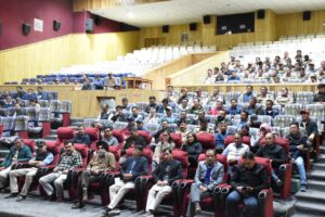
Under the 3-day training schedules 2 batches consisting of 44 participants under the categories Technical Assistants and Gram Rojgar Sevak received orientation on the application of GIS tools for characterizing the landscapes to develop MGNREGA (Mahatma Gandhi National Rural Employment Guarantee Act) plans of their respective Gram Panchayat.
The geovisualization is expected to help in work identification for augmentation of water resources based on the Land Use Land Classification and their execution, following the CWRM framework conceptualized in WASCA.
After getting resolution through Gram Sabha, the plans will be submitted to the district for their technical and financial sanctions. The longer aim is to access the convergence of MGNREGA with the schemes of PMKSY-WDC 2.0, Jal Shakti Abhiyan – Catch the Rain, etc.
The training content covered by the experts encompassed the topics – intervention of MGNREGA in strengthening NRM; expected convergence of government schemes with MGNREGA; the role of GIS tools for planning; practical sessions by the participants.
The training objectives were to demonstrate GIS & RS as a time-saving and efficient tool in planning NRM works, capacity building of the block level, and GP functionaries on the preparation of the GIS-based NRM plan for the strategic convergence with MGNREGA with a focus on water security and climate change adaptation and improved productivity and development of GIS-based Gram Panchayat action plans of Block by the participants and their submission in the Gram Sabha for inclusion in MGNREGA shelf of the works and other developmental programs.
The trainings were presided over by Sonam Norbo, Assistant Development Commissioner; Assistant Director, RDD; Senior Scientist and Principal Scientist of CAZRI, Technical Advisor, GIZ; State Coordinator, WASCA-II and GIS Experts.
Related Posts

Chief Electoral Officer UT Ladakh Flags Off Polling Teams for 1-Ladakh Parliamentary Constituency

State Nodal Officer, SVEEP Ladakh, Dr Tsewang Morup Conducts Extensive Voter Awareness Program for General Elections 2024
District Election officer Leh conducts training for Zonal /Sectoral Magistrates and Zonal/Sectoral police

LS polls: Sixth schedule, employment key issues in Ladakh

LS polls: Sixth schedule, employment key issues in Ladakh

Joint Chief Electoral Officer, Ladakh, Sonam Chosjor Launches Voter Awareness Initiative for General Elections 2024

Ladakhis united over Sixth Schedule demand despite division on LS polls: Buddhist leader
