J&K Forest Department pioneers DGPS adoption, ushering a new era of forest governance
JAMMU, MAY 24: In a landmark move towards integrating cutting-edge geospatial technology in forest governance, the Jammu & Kashmir Forest Department organized a Hands-on Training cum Workshop on Differential Global Positioning System (DGPS) here at the Forest Resource Management Centre (FRMC), Narwal, today. The workshop witnessed enthusiastic participation from forest field staff of both Territorial and Non-Territorial divisions falling under the East Circle, Jammu.
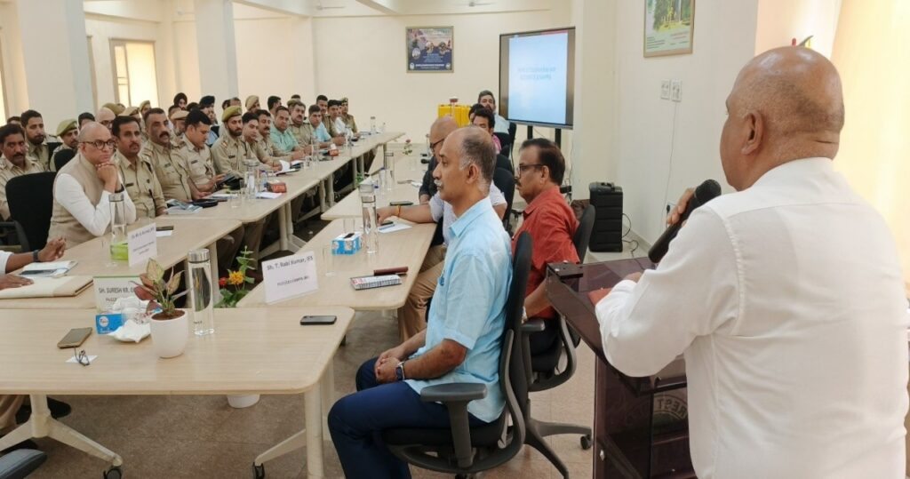
The event was held under the guidance and presence of senior leadership from the department. The workshop was inaugurated and led by PCCF & Head of Forest Force (HoFF), J&K Forest Department, Suresh Kumar Gupta, alongside other dignitaries including T. Rabi Kumar, PCCF & CEO J&K CAMPA, Chaturbhuja Behera, APCCF & Director JKFRI, M.K. Kumar, CCF Jammu and other senior officers.
The dignitaries collectively stressed on the strategic importance of DGPS technology in modern forest management. Speaking on the occasion, Sh. Gupta highlighted that DGPS equipment enables high-precision geospatial mapping with millimeter-level accuracy, which is indispensable for accurate demarcation of forest boundaries, detection and prevention of encroachments and effective resolution of land-related disputes and court cases.
The workshop was technically conducted by a specialized team from M/s MAPPA, a reputed geospatial solutions provider, under the leadership of Niten Patial, CEO, MAPPA. The training included a detailed presentation on the functionality, field application and data acquisition techniques of DGPS devices, followed by a comprehensive hands-on field training session, allowing forest staff to practically engage with the technology on-ground.
This initiative marks a historic milestone for the J&K Forest Department, as it becomes the first and only department in the Union Territory to have successfully procured and operationalized DGPS devices for its field operations. This adoption is set to revolutionize forest conservation, scientific demarcation and landscape-level planning.
By equipping its field personnel with advanced tools and knowledge, the department has reaffirmed its commitment to transparent, accountable and technology-driven governance of forest resources. The precision mapping enabled by DGPS will also significantly contribute to biodiversity protection, ecosystem integrity and legal safeguards for forest land.
The workshop concluded with a vote of thanks and a strong resolve from all participants to implement the learnings in their respective jurisdictions.